


visit the stamford friary sites
THE STAMFORD FRIARY CONUNDRUM EXPLAINED & GUIDED WALK

Information on ‘Joan the fair maid of kent, 1st princess of wales’
SELECTED HISTORIC MAPS OF STAMFORD
Map M1: Parliamentary Map Lincolnshire, surveyed by T Baderslade & engraved by W Toms 1742
Map M8 ‘Prospect of the town of Stanford from Parson’s Cross' 1719, in Peck 1727, Plate 3
Maps M3, M3a and M3b: Stamford town plan based on 1887 OS 1:2500, artwork by P Clark 2018
Map M11 ’Speed’s Map of Stamford taken in 1600, amended by W Harrod 1785’
Gallery
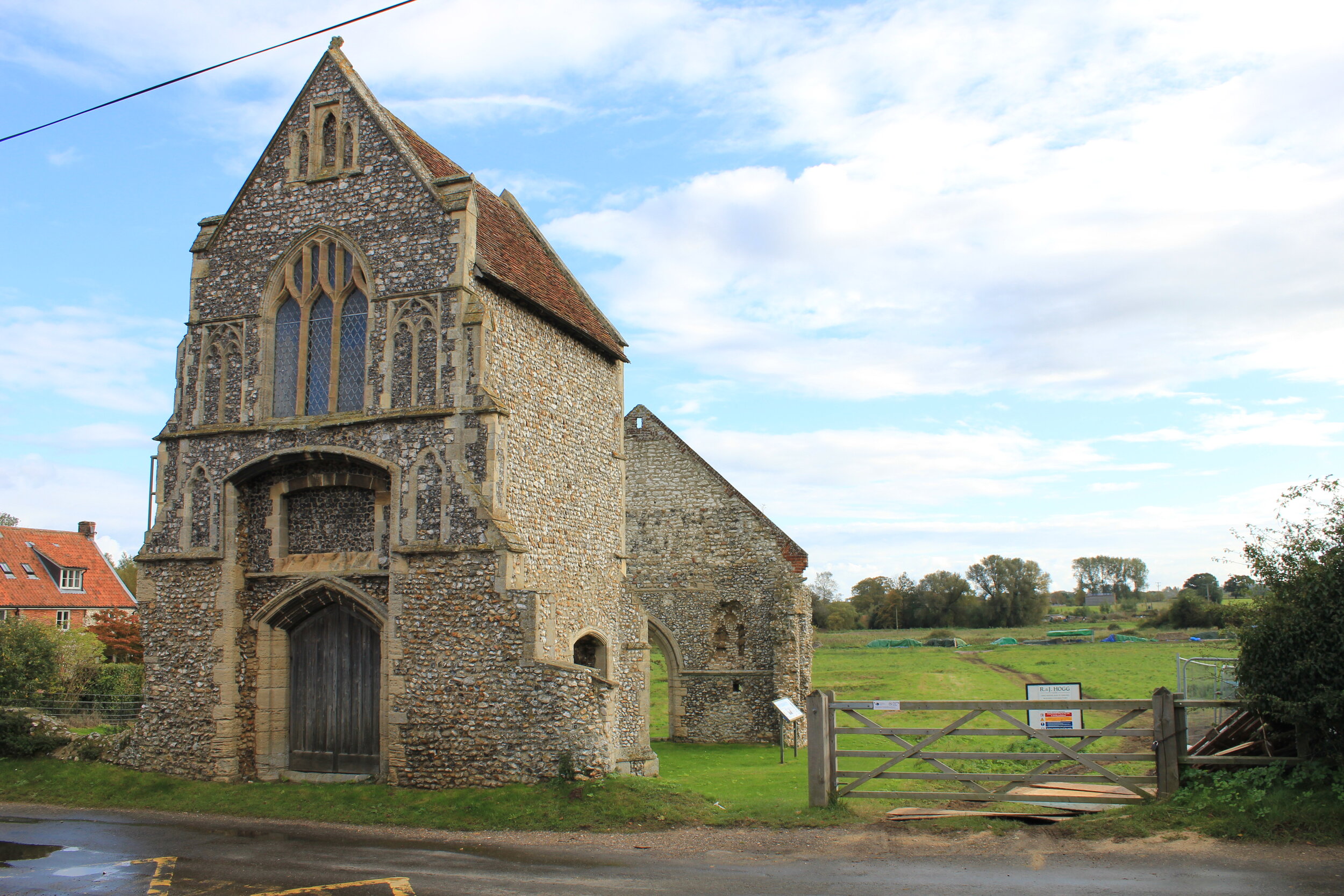
Burnham Norton, White Friars gatehouse (exterior)
Burnham Norton, White Friars gatehouse (internal view)

Chichester, chancel of the Grey Friars church

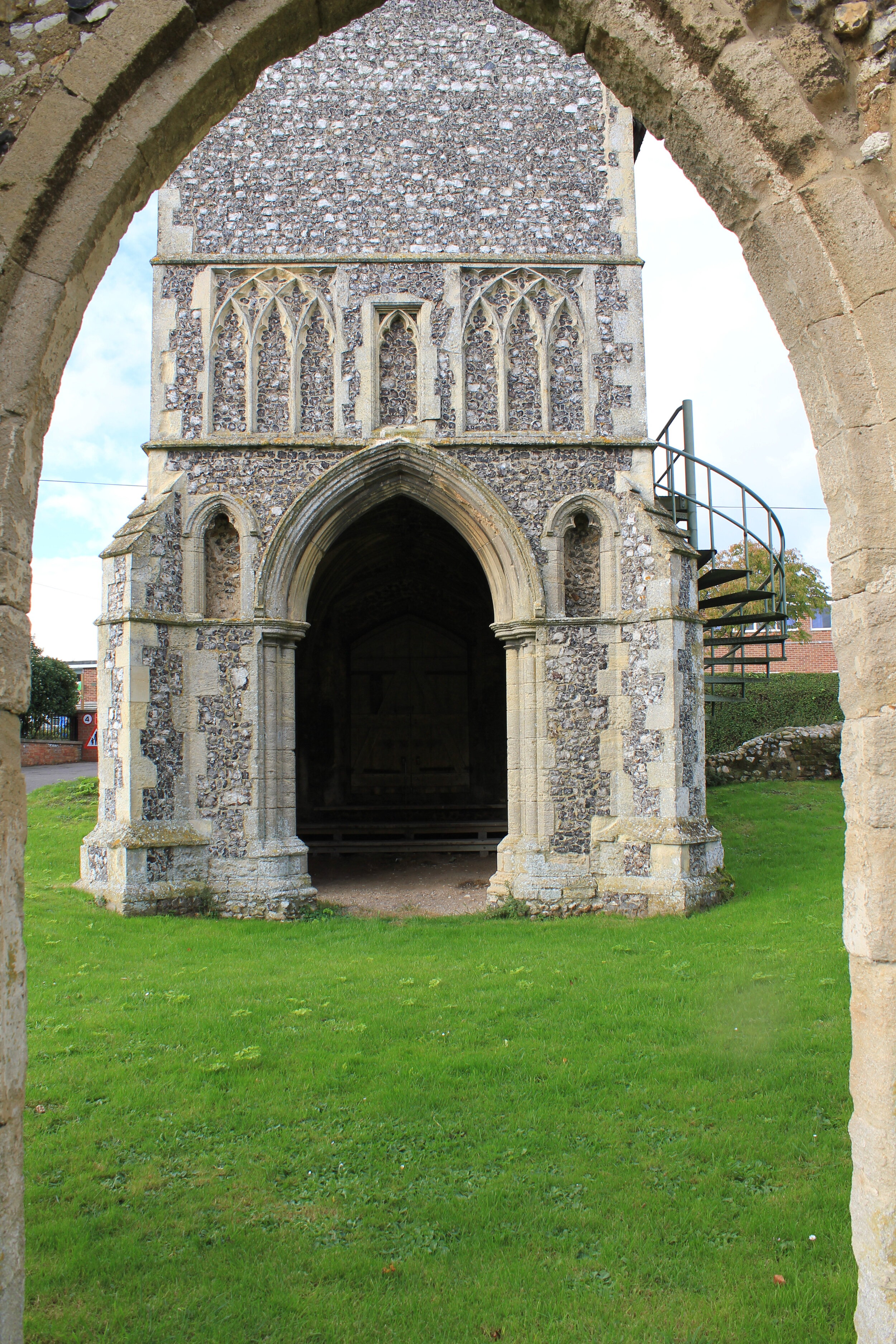
King’s Lynn, Grey Friars hexagonal bell tower

Canterbury, Grey Friars guest house built over River Stour

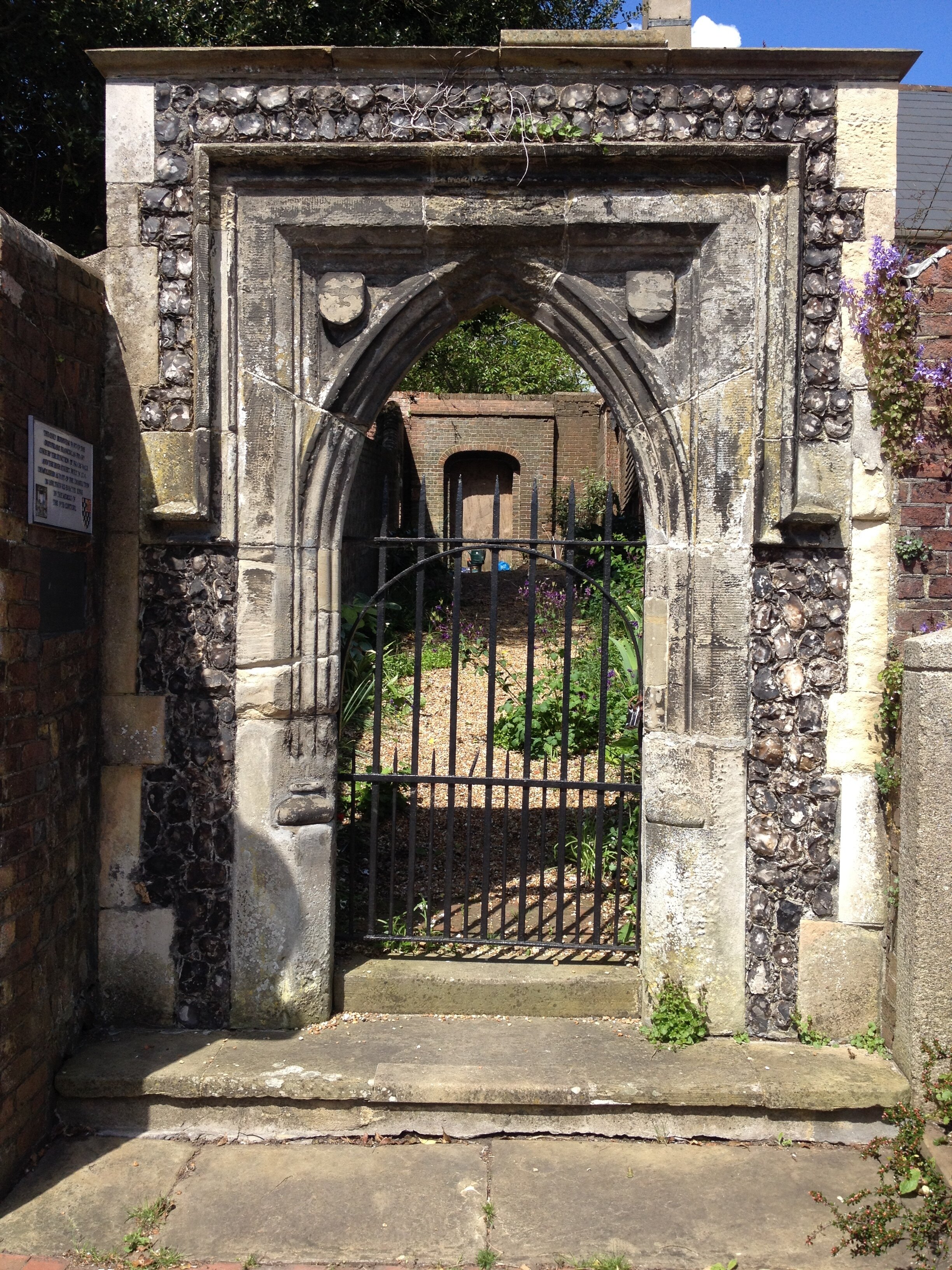
Norwich, White Friars gate, removed to Arminghall Hall, Bixley. Now installed at Norwich Magistrates' Courts
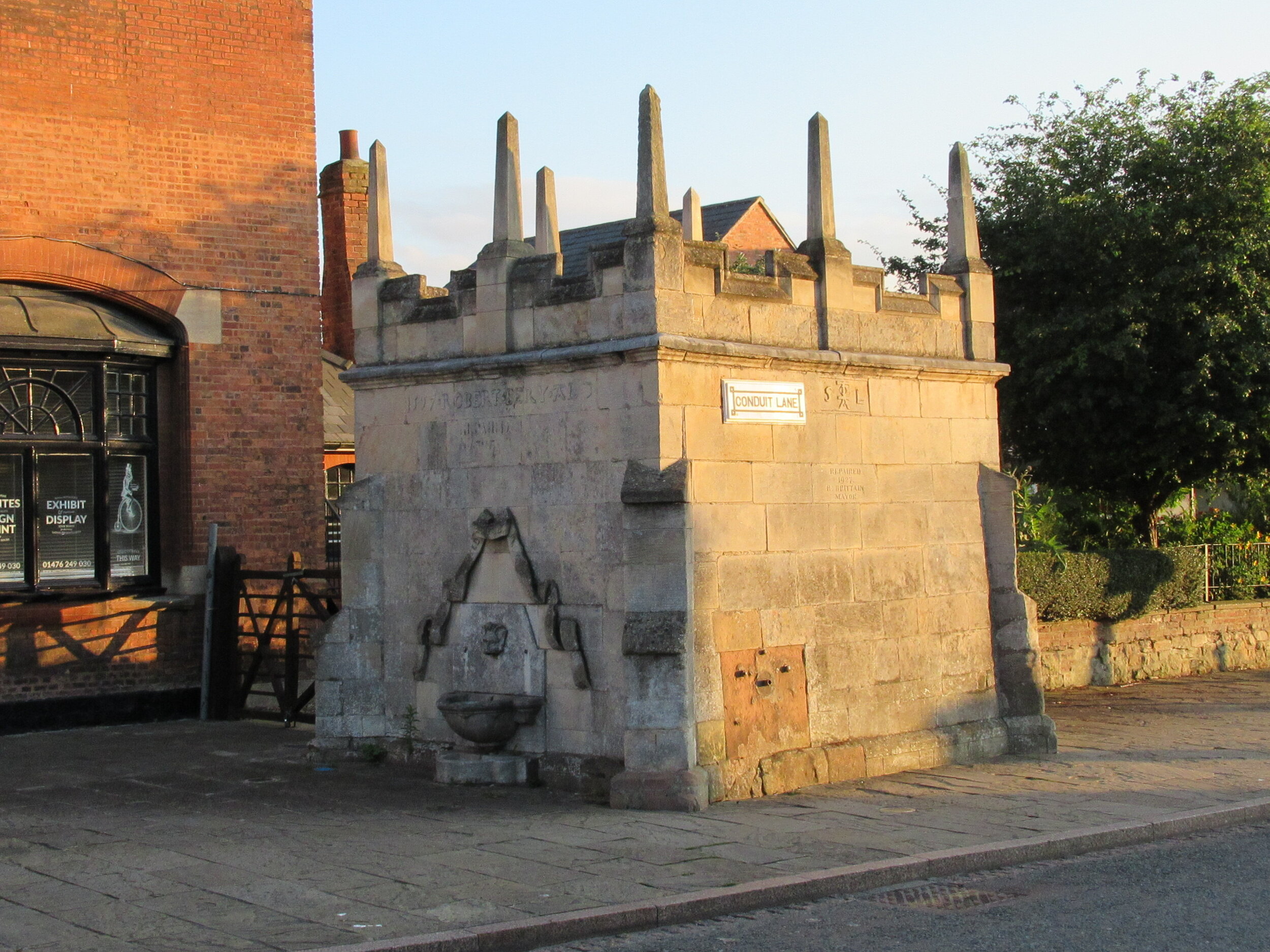
Grantham, Grey Friars conduit house, market place
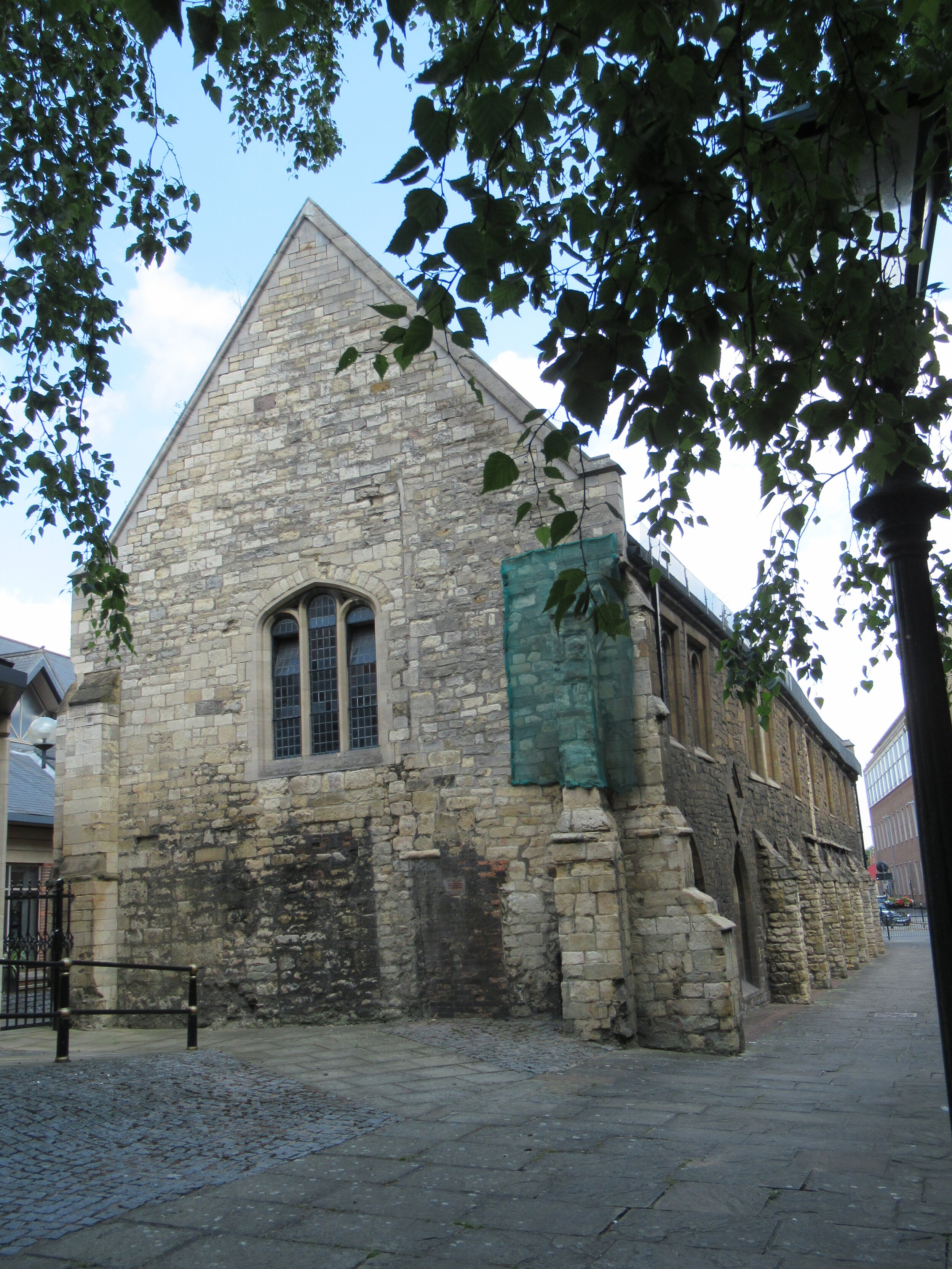
Lincoln, remains of friary infirmary at the Grey Friars

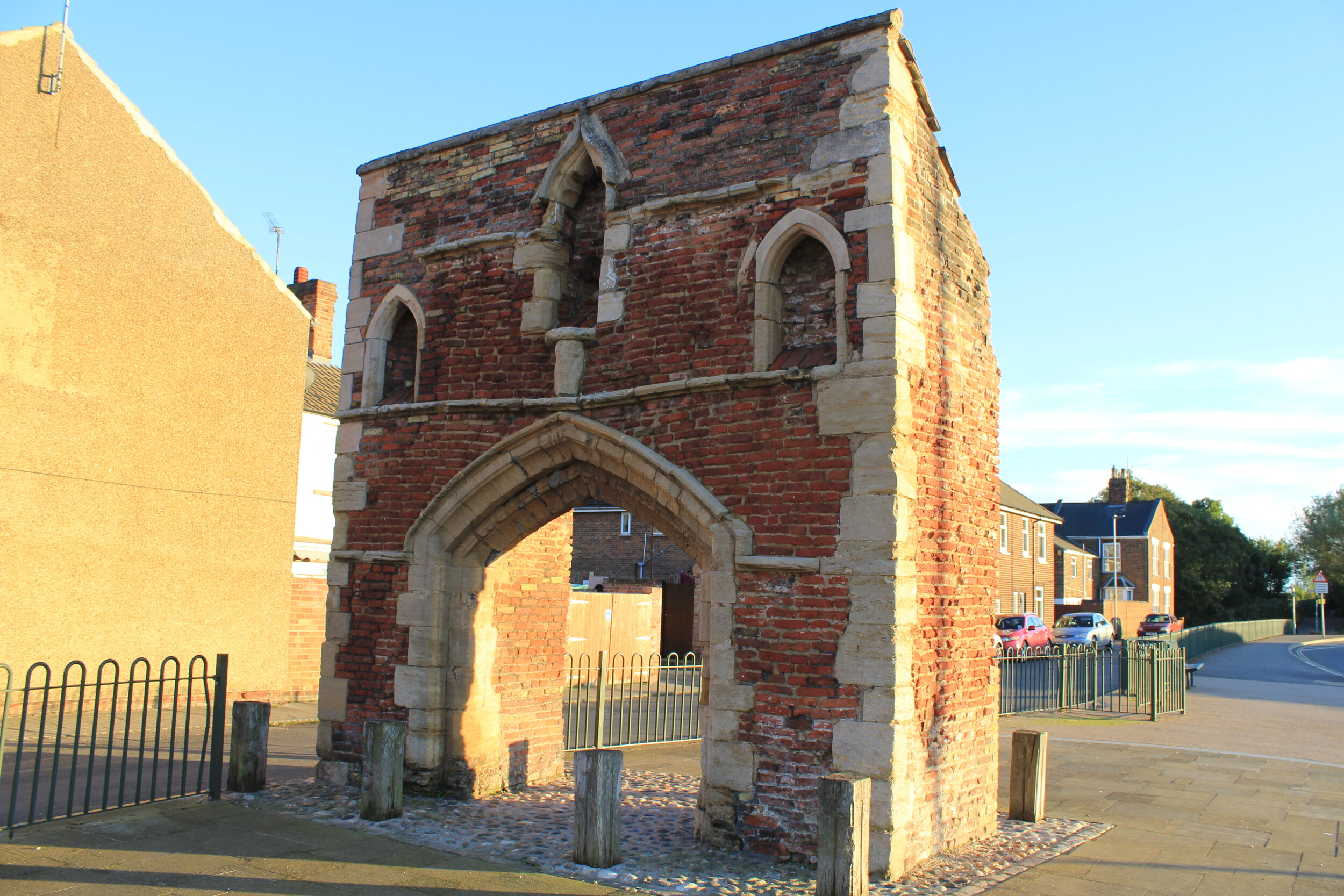
Stamford, gate ascribed to the Grey Friars or the White Friars (exterior)
King’s Lynn, White Friars gatehouse (exterior)
Lewes, Grey Friars gateway (exterior)
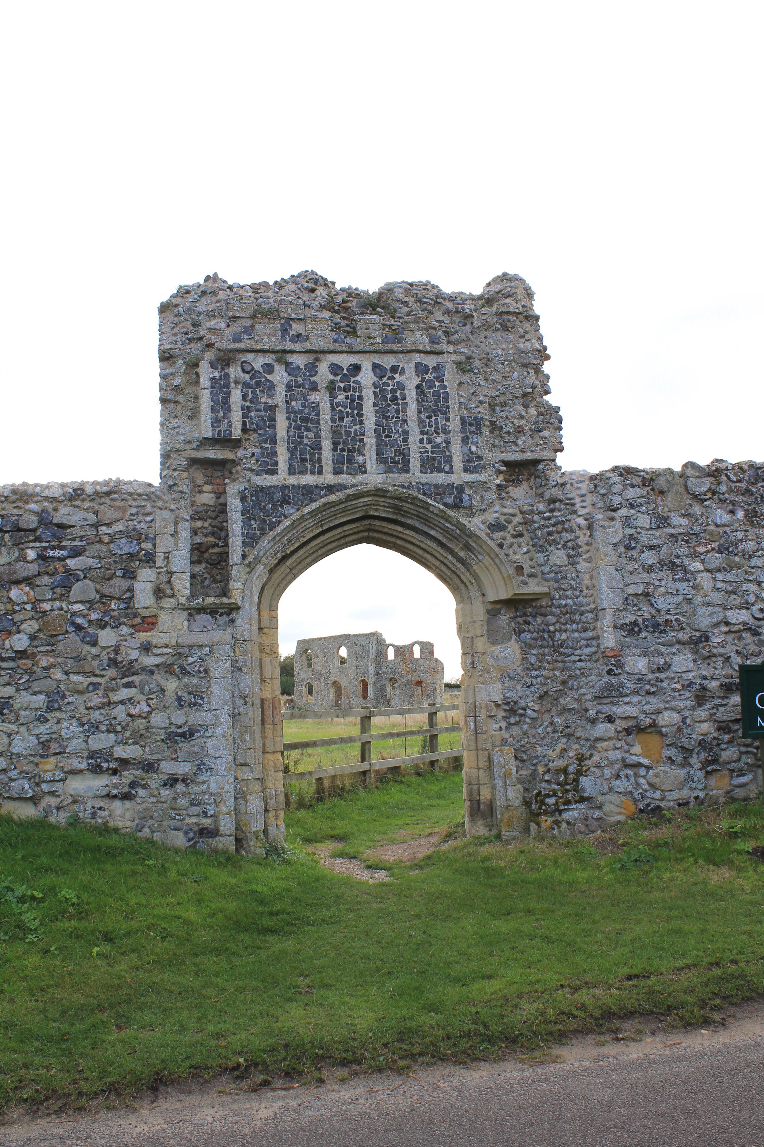
Dunwich, entrance to walled site of the Grey Friars
